
About Us
History
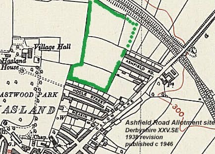
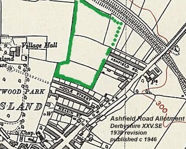
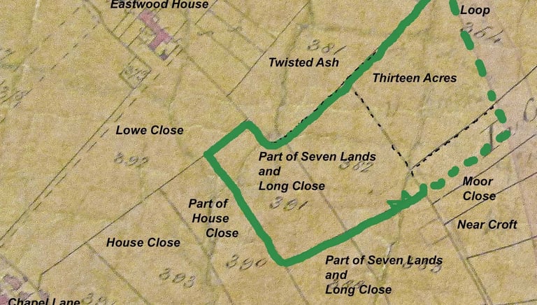
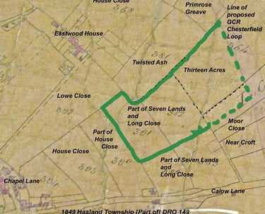
The Hasland Allotments have a fascinating history! The earliest map of the site dates back to 1849, revealing the field boundaries that shaped the allotment area. These allotments were established sometime after World War I, as part of a national movement to provide leisure gardens for the public. If you happen to have any old photos or additional information about the site, feel free to share —it’s always interesting to learn more about local history!
Ashfield Road Allotment Society
Ashfield Road, Hasland, Chesterfield,
S41 0AZ
ashfieldroadallotments@gmail.com
07442450950
© 2025. All rights reserved.